Peloponnese, Greece
Peloponnese Olive Light
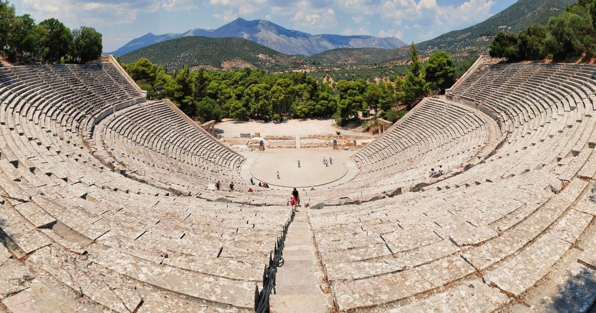
Old groves, empty inland roads, and shade offered exactly when needed.
Why this monthThe heat lets go and the sea stays warm — September is the Peloponnese at its most generous, with harvest light in the olive terraces.
Full route, maps & GPX on BicycleMovementOpens the official page in a new tab. Nothing is sold here — how the link works.
- Distance
- 355 km
- Duration
- 6 days
- Ascent
- 4,400 m
- Country
- Greece
The seasonThe heat lets go and the sea stays warm — September is the Peloponnese at its most generous, with harvest light in the olive terraces. How we read the weather window · the September edition.
The Soul Score is BicycleMovement's official figure for this route, shown here exactly as published on Peloponnese Olive Light route page.
Best time to cycle Peloponnese Olive Light
- Best months
- April – June and September – October
- Difficulty
- Moderate
The Peloponnese is at its kindest either side of high summer, when the light is long and the heat is workable all day. In August the route still rides beautifully if the day is split around it: early hours inland through the terraces, a long rest through the middle, and the last hours back toward the sea. Rain is rare; shade and water plans matter more than waterproofs.
We would avoid the peak heat of July and early August in the middle of the day. See the month-by-month weather window for Greece
How hard is Peloponnese Olive Light?
Inland roads climb away from the coast and return to it, so the ascent accumulates steadily across the week. Surfaces are good and gradients reasonable — heat is the governing factor, and the answer to it is the clock rather than fitness.
On the roadInland roads through olive terraces, climbing away from the coast and returning to it. Ride the early hours, rest through the middle of the day, and plan water at village fountains — they are reliable and frequent.
Gradients, surface changes and the full elevation profile are published on the official Peloponnese Olive Light page on BicycleMovement, which is the complete version of this journey.
What the route is remembered for
Olive terraces inland
Silver-grey slopes stitched with dry-stone walls, and roads that climb through them in long easy switchbacks.
Village fountains
Reliable, cold and frequent — the reason a hot day here is manageable.
The sea returning
Days that end back at the coast after a morning in the hills, which never stops being a good arrangement.
Stone villages in the heat of the day
Shuttered squares, one open café, and the sense that resting through the middle hours is the local intelligence.
Peloponnese Olive Light cycling itinerary
6 days of riding, 355 km and 4,400 m of ascent, shaped the way we would ride it — short mornings, long afternoons, and no day that has to be finished.
Days 1–2
Coast to olive country
Leave the sea early and climb into groves that go on for hours.
Days 3–4
Arcadian highlands
Cool inland air, stone villages, and the longest climbing days of the route.
Day 5
Descent to the gulf
A long drop back toward the water through terraces and cypress.
Days 6–7
Southern shore
Warm sea swims, short mornings in the saddle, and a finish that refuses to hurry.
The full route
GPX files, offline maps, the elevation profile, day-by-day notes and the planning tools for Peloponnese Olive Light all live on BicycleMovement. We keep only the season and the reason.
Get the GPX + full route on BicycleMovementOpens the official page in a new tab. No signup here, nothing sold here.
Peloponnese Olive Light: common questions
- When is the best time to ride Peloponnese Olive Light?
- April – June and September – October. The Peloponnese is at its kindest either side of high summer, when the light is long and the heat is workable all day. In August the route still rides beautifully if the day is split around it: early hours inland through the terraces, a long rest through the middle, and the last hours back toward the sea. Rain is rare; shade and water plans matter more than waterproofs. Month-by-month season guide for Greece
- How many days does it take?
- 6 days at an unhurried pace — 355 km with 4,400 m of ascent through Peloponnese, Greece. Strong riders shorten it; we would not. The day-by-day breakdown, with distances and overnight options, is on the full Peloponnese Olive Light route page.
- How difficult is Peloponnese Olive Light?
- Moderate. Inland roads climb away from the coast and return to it, so the ascent accumulates steadily across the week. Surfaces are good and gradients reasonable — heat is the governing factor, and the answer to it is the clock rather than fitness.
- What are the roads and surfaces like?
- Inland roads through olive terraces, climbing away from the coast and returning to it. Ride the early hours, rest through the middle of the day, and plan water at village fountains — they are reliable and frequent.
- How do I get to the start?
- Kalamata and Athens both serve the region, and buses reach the smaller coastal towns with bikes stowed underneath.
- Where do I download the GPX file, maps and elevation profile?
- On the official route page. Get the GPX for Peloponnese Olive Light on BicycleMovement — offline maps, the elevation profile and the planning tools are held there too.
The full route
GPX files, offline maps, the elevation profile, day-by-day notes and the planning tools for Peloponnese Olive Light all live on BicycleMovement. We keep only the season and the reason.
Open the official route pageOpens the official page in a new tab. No signup here, nothing sold here.