Nicoya Peninsula, Costa Rica
Nicoya Peninsula Blue Zone Ride
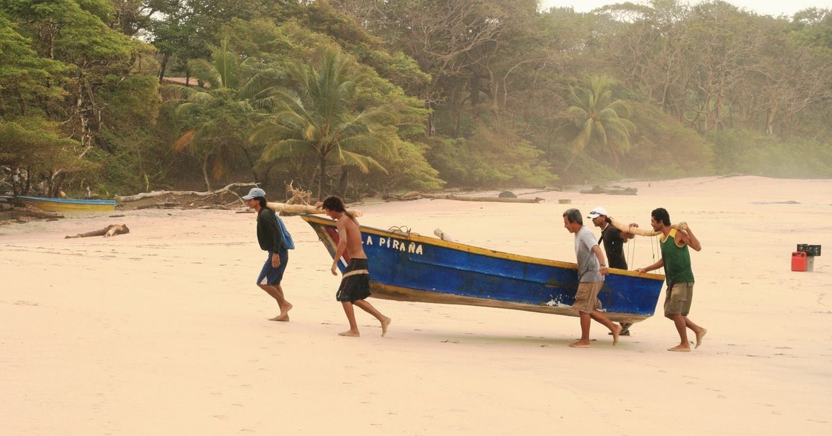
Dry-forest tracks between headlands, ridden at the pace the villages keep.
Why this monthDeep green and almost empty; ride the mornings and let the afternoon rain wash the dust off the tracks.
Full route, maps & GPX on BicycleMovementOpens the official page in a new tab. Nothing is sold here — how the link works.
- Distance
- 310 km
- Duration
- 6 days
- Ascent
- 3,900 m
- Country
- Costa Rica
The seasonDeep green and almost empty; ride the mornings and let the afternoon rain wash the dust off the tracks. How we read the weather window · the September edition.
The Soul Score is BicycleMovement's official figure for this route, shown here exactly as published on Nicoya Peninsula Blue Zone Ride route page.
Best time to cycle Nicoya Peninsula Blue Zone Ride
- Best months
- July – August, in the veranillo
- Difficulty
- Moderate
The veranillo — Costa Rica's little dry spell inside the green season — is the reason to ride Nicoya in these weeks. The tracks that turn to mud in September are firm, the hills are still green from the early rains, and the sea is warm without the high-season crowds of the December to April window. The Papagayo wind that scours the north of the peninsula from December to March has gone quiet.
We would avoid September and October, the wettest weeks on the Pacific side. See the month-by-month weather window for Costa Rica
How hard is Nicoya Peninsula Blue Zone Ride?
Distances are short but the profile is restless: dirt roads between headlands rise and fall constantly, and the climbs are brief and sharp rather than long. Heat, not gradient, sets the pace — ride the early hours and the day stays easy.
On the roadRolling dirt and hard-packed track between headlands, with short sharp climbs rather than long ones. Ride early, finish by mid-afternoon, and carry two bottles between beach villages; a gravel bike or light tourer suits it best.
Gradients, surface changes and the full elevation profile are published on the official Nicoya Peninsula Blue Zone Ride page on BicycleMovement, which is the complete version of this journey.
What the route is remembered for
Blue Zone villages
A stretch of coast where people live unusually long lives, and the daily rhythm — early, slow, communal — is the reason why.
Dry forest between headlands
Hard-packed track through tall dry forest, with the ocean appearing and disappearing over each rise.
Empty beaches at either end of the day
Nosara, Sámara and the coves between them, quiet in the hours when the light is best.
Water at the village fountain
Small towns close enough together that two bottles are always enough.
Nicoya Peninsula Blue Zone Ride cycling itinerary
6 days of riding, 310 km and 3,900 m of ascent, shaped the way we would ride it — short mornings, long afternoons, and no day that has to be finished.
Days 1–2
Into the peninsula
Ferry or the long way round, then dry-forest tracks inland where the villages set the pace.
Days 3–4
Headland to headland
Short, steep, repeated climbs between beaches, with a swim at the end of each one.
Day 5
Inland loop
A quiet day away from the coast among smallholdings and centenarian villages.
Day 6
Back to the water
A last coastal run with an early finish, timed for the evening light.
The full route
GPX files, offline maps, the elevation profile, day-by-day notes and the planning tools for Nicoya Peninsula Blue Zone Ride all live on BicycleMovement. We keep only the season and the reason.
Get the GPX + full route on BicycleMovementOpens the official page in a new tab. No signup here, nothing sold here.
Nicoya Peninsula Blue Zone Ride: common questions
- When is the best time to ride Nicoya Peninsula Blue Zone Ride?
- July – August, in the veranillo. The veranillo — Costa Rica's little dry spell inside the green season — is the reason to ride Nicoya in these weeks. The tracks that turn to mud in September are firm, the hills are still green from the early rains, and the sea is warm without the high-season crowds of the December to April window. The Papagayo wind that scours the north of the peninsula from December to March has gone quiet. Month-by-month season guide for Costa Rica
- How many days does it take?
- 6 days at an unhurried pace — 310 km with 3,900 m of ascent through Nicoya Peninsula, Costa Rica. Strong riders shorten it; we would not. The day-by-day breakdown, with distances and overnight options, is on the full Nicoya Peninsula Blue Zone Ride route page.
- How difficult is Nicoya Peninsula Blue Zone Ride?
- Moderate. Distances are short but the profile is restless: dirt roads between headlands rise and fall constantly, and the climbs are brief and sharp rather than long. Heat, not gradient, sets the pace — ride the early hours and the day stays easy.
- What are the roads and surfaces like?
- Rolling dirt and hard-packed track between headlands, with short sharp climbs rather than long ones. Ride early, finish by mid-afternoon, and carry two bottles between beach villages; a gravel bike or light tourer suits it best.
- How do I get to the start?
- Liberia airport is a few hours from the northern end of the peninsula; buses and small ferries connect back to the mainland at the finish.
- Where do I download the GPX file, maps and elevation profile?
- On the official route page. Get the GPX for Nicoya Peninsula Blue Zone Ride on BicycleMovement — offline maps, the elevation profile and the planning tools are held there too.
The full route
GPX files, offline maps, the elevation profile, day-by-day notes and the planning tools for Nicoya Peninsula Blue Zone Ride all live on BicycleMovement. We keep only the season and the reason.
Open the official route pageOpens the official page in a new tab. No signup here, nothing sold here.