Costa Rica, coast to coast
Pacific to Caribbean Traverse
One country, two oceans, and a long green mountain corridor in between.
Why this monthWet on both coasts but cool and clear up high — for riders who want the mountain corridor more than the beaches.
Full route, maps & GPX on BicycleMovementOpens the official page in a new tab. Nothing is sold here — how the link works.
- Distance
- 520 km
- Duration
- 8 days
- Ascent
- 7,800 m
- Country
- Costa Rica
The seasonWet on both coasts but cool and clear up high — for riders who want the mountain corridor more than the beaches. How we read the weather window · the September edition.
The Soul Score is BicycleMovement's official figure for this route, shown here exactly as published on Pacific to Caribbean Traverse route page.
Best time to cycle Pacific to Caribbean Traverse
- Best months
- July – August
- Difficulty
- Demanding
A traverse crosses two weather systems, so no month is perfect on both coasts — the little dry spell is the best compromise. The Pacific side is settled, the high crossing is cool and clear in the mornings, and the Caribbean descent runs into its own calmer stretch of the year. Expect afternoon cloud on the pass whatever the month.
We would avoid September and October on the Pacific side. See the month-by-month weather window for Costa Rica
How hard is Pacific to Caribbean Traverse?
One sustained high crossing dominates the week — a long climb to cool, exposed air, then a descent that keeps going into humidity. Surfaces are paved for most of it, so the difficulty is altitude gain and the sharp change in temperature between the top and either coast.
On the roadOne sustained high crossing joins two very different coasts — cool, exposed air on the pass, warm humid air on both descents. Roads are paved for most of the traverse, with buses available on the long valley sections if a day runs late.
Gradients, surface changes and the full elevation profile are published on the official Pacific to Caribbean Traverse page on BicycleMovement, which is the complete version of this journey.
What the route is remembered for
Ocean to ocean
Two seas in one week, joined by a single mountain crossing — the simplest possible shape for a journey.
The high pass
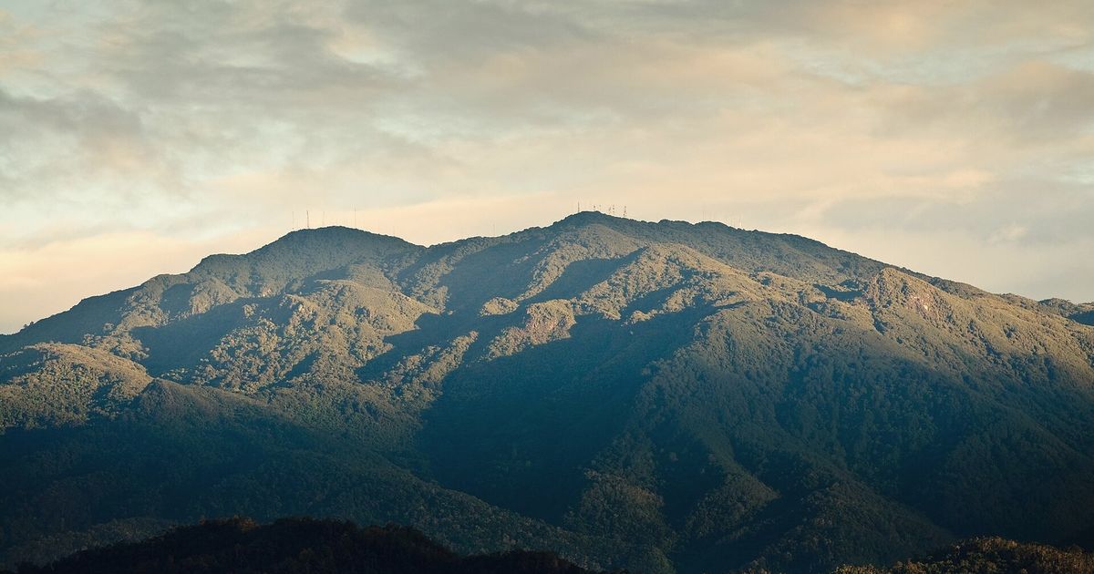
Cold, thin, quiet air above the cloud, and a summit that feels a long way from either coast.
Two entirely different countries
Dry Pacific light on one side, deep green Caribbean humidity on the other, within three days of each other.
Valley roads with an escape
Buses shadow the long valley sections, so a day that runs late never has to be finished in the dark.
Pacific to Caribbean Traverse cycling itinerary
8 days of riding, 520 km and 7,800 m of ascent, shaped the way we would ride it — short mornings, long afternoons, and no day that has to be finished.
Days 1–2
Pacific coast to the foothills
Warm flat riding, then the first sustained climb away from the ocean.
Days 3–4
The cordillera
The high crossing — cold cloud-forest air, the longest ascent of the route, and a summit day that feels like another country.
Days 5–6
Caribbean slope
A long green descent through banana country and river valleys, air thickening kilometre by kilometre.
Days 7–8
The other ocean
Flat lanes to the Caribbean shore, finishing where the water is warm and the calendar is different.
The full route
GPX files, offline maps, the elevation profile, day-by-day notes and the planning tools for Pacific to Caribbean Traverse all live on BicycleMovement. We keep only the season and the reason.
Get the GPX + full route on BicycleMovementOpens the official page in a new tab. No signup here, nothing sold here.
Pacific to Caribbean Traverse: common questions
- When is the best time to ride Pacific to Caribbean Traverse?
- July – August. A traverse crosses two weather systems, so no month is perfect on both coasts — the little dry spell is the best compromise. The Pacific side is settled, the high crossing is cool and clear in the mornings, and the Caribbean descent runs into its own calmer stretch of the year. Expect afternoon cloud on the pass whatever the month. Month-by-month season guide for Costa Rica
- How many days does it take?
- 8 days at an unhurried pace — 520 km with 7,800 m of ascent through Costa Rica, coast to coast. Strong riders shorten it; we would not. The day-by-day breakdown, with distances and overnight options, is on the full Pacific to Caribbean Traverse route page.
- How difficult is Pacific to Caribbean Traverse?
- Demanding. One sustained high crossing dominates the week — a long climb to cool, exposed air, then a descent that keeps going into humidity. Surfaces are paved for most of it, so the difficulty is altitude gain and the sharp change in temperature between the top and either coast.
- What are the roads and surfaces like?
- One sustained high crossing joins two very different coasts — cool, exposed air on the pass, warm humid air on both descents. Roads are paved for most of the traverse, with buses available on the long valley sections if a day runs late.
- How do I get to the start?
- Both ends are within reach of San José by bus or short transfer, which makes the traverse easy to bookend with flights.
- Where do I download the GPX file, maps and elevation profile?
- On the official route page. Get the GPX for Pacific to Caribbean Traverse on BicycleMovement — offline maps, the elevation profile and the planning tools are held there too.
The full route
GPX files, offline maps, the elevation profile, day-by-day notes and the planning tools for Pacific to Caribbean Traverse all live on BicycleMovement. We keep only the season and the reason.
Open the official route pageOpens the official page in a new tab. No signup here, nothing sold here.